Home » Divisions » Regional Planning & Services » Water Central Texas
Water Central Texas
The use and conservation of water in Central Texas can be a complex issue. CAPCOG has compiled general information about water issues, plans and more throughout the ten-county region to help provide a better understanding of topics related to water planning.
State Water Plan
Every five years, the state’s Regional Water Planning Groups create plans for their regions, and each plan is incorporated into the State Water Plan. The following analysis was extracted and compiled data for the ten-county CAPCOG region from the 2021 Regional Water Plans for Regions G, K, and L. Portions of those regions resides within the CAPCOG geographic boundaries. This data focuses on decadal projections from 2020-2070 for population, water demand, water supply, water needs, and water management strategies to address needs.
This data is useful in planning for economic development, transportation, land management, and many other areas. From a community perspective, this data is unique as it provides a glimpse of the future and can help plan future growth and build a more resilient community in case of water shortage.
Water Infrastructure Funding Information
TWDB’s State Water Implementation Fund for Texas (SWIFT)
The SWIFT program helps communities develop and optimize water supply projects in the state’s water plan at cost-effective rates. The program provides low-interest loans, extended repayment terms, deferral of loan repayments, and incremental repurchase terms for projects with state ownership aspects.
EPA’s Water Infrastructure and Resiliency Finance Center
The center provides financing information to help local decision makers make informed decisions for drinking water, wastewater and stormwater infrastructure to protect human health and the environment.
EPA’s Water Infrastructure Finance and Innovation Act (WIFIA)
The WIFIA program accelerates investment in our nation’s water infrastructure by providing long-term, low-cost supplemental loans for regionally and nationally significant projects.
Deadlines: Letters of Interest were due by Oct. 15, 200, but the program opens annually.
Presentations of State Water Plan Data from CAPCOG
The following presentations were created by CAPCOG in order to represent the 2017 State Water Plan data for the CAPCOG region.
CAPCOG Excel Analyses
The following Excel documents are various analyses performed by CAPCOG of the 2017 State Water Plan data.
Water Planning Regions and Districts in CAPCOG
The interactive map compiles all of the water planning regions and districts in the region. Use the layer list to turn off/on certain water districts or regions. Click on a point of interest to discover its district or region. Use the arrows at the top of the pop-up box to cycle through the point-of-interest’s layers.
Drought & Conservation
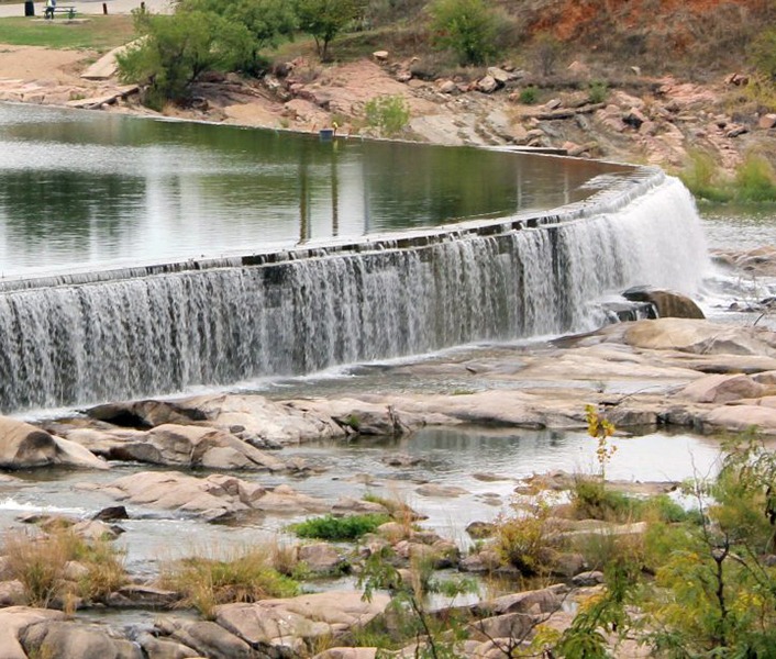
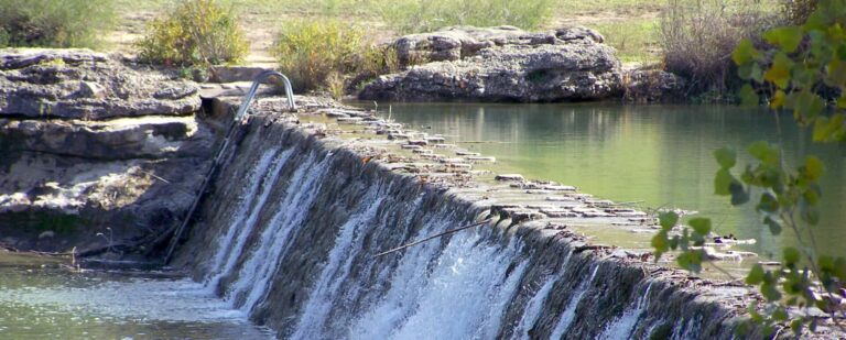
Central Texas is prone to droughts just as much as it is prone to flash floods. This makes conservation topics and data valuable, so jurisdictions can better manage and protect their water supplies and usage. The Texas Water Development Board’s Water Data for Texas is updated daily to show current reservoir levels and current water wells in Texas. CAPCOG has also compiled outreach messaging on drought and conservation from state agencies and local governments.
Water Levels
Monitoring current water levels, surface water and groundwater, is important in understanding drought conditions. During drought times, reservoir levels may decline rapidly while many aquifers decline every year regardless of drought. Droughts cause aquifers levels to decline quickly.
Drought and Conservation Outreach Tools
As a result of declining surface water and groundwater during a drought, many cities and water systems will initiate water conservation measures. Below is a list of measures and outreach items used to discuss drought and promote water conservation.
Conservation Case Studies
EPA’s WaterSense Awards
Each year, the EPA’s WaterSense Partners, organizations that enhance the market for water-efficient products, practice and services, recognizes entities that go above and beyond in supporting such projects. These awards can be viewed as case studies for cities and counties nationwide. Texas cities have received this award.
Buda conserves water for today, tomorrow (posted Aug. 2019)
Buda is intensifying its water conservation efforts by replacing its water meter reading system and building an aquifer storage and recovery facility. To save water today, Buda is installing an advanced water metering infrastructure that uses wireless communication technologies to read the meters remotely without accessing them in the ground. These new meters allow customers, residential and commercial, and the city to view water usage data instantly, which can quickly help identify leaks and lead to repairs before they cause excess water loss. To save water for the future, the aquifer storage and recovery facility will allow the city to store about 100 million gallons for future use. The facility will pump treated water into the Trinity Aquifer allowing it to be withdrawn for later use. Once completed, the new facility will allow Buda to diversify its water supply sources and decrease Buda’s reliance on the Edwards Aquifer.
Horseshoe Bay Conservation Efforts
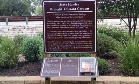
Horseshoe Bay’s Water Conservation Program focuses on reducing the use of irrigation systems. Irrigation systems, which are supposed to be efficient, consume more than half the water used by the city’s residents each year. The city finds homeowners are not knowledgeable or sufficiently engaged in operating their systems, so it encourages residents to understand their automatic controllers by checking their systems at least twice a month. The city also encourages monthly checks for broken heads and other problems, and it will audit residential systems for free. Horseshoe Bay also promotes that residents plant drought resistant gardens using native Central Texas plants. Such plants are drought tolerant, require less watering and have many other environmental benefits.
Lago Vista updates pipes, modifies storage tanks to conserve (posted March 2019)
Through a study in 2009, the City of Lago Vista determined that 35 percent of the water sent through their distribution system was lost due to poor mixing in ground storage tanks, dead-end waterlines, and leaking pipes. Since the city has a low population density, the water age for residental water in storage tanks is higher than normal, increasing the abundance of Trihalomethanes present in the water. To keep the Trihalomethanes below the EPA-mandated maximum contaminant level, the city was flushing their seven ground storage tanks on a regular basis. This task required the city to buy potable drinking water, empty the storage tanks and refill them with water, wasting thousands of gallons each time. A city task force sought an innovative solution to the water loss problem and identified strategies to fix it. One of the solutions was for Lago Vista to replace their old, leaky pipes to flexible, leak-free high-density polyethylene (HDPE) pipes. The city replaced its entire water system with the HDPE pipes. Additionally, Lago Vista added fused pipe mixers into the ground storage tanks, allowing for constant turnover in the tanks. They also pioneered the use of splash pumps in the ground storage tanks to remove the Trihalomethanes, which results in a 61 percent decrease in the chemical. These ground storage tank improvements now allow the tanks to safely go without flushing for months. With the new technique used in the Lago Vista ground storage tanks and the replacement of old pipes with HDPE pipes, the city’s water distribution system now has a 12 percent loss. Lago Vista no longer purchases water to flush their ground storage tanks, resulting in about 6.4 acre-feet of water conserved annually and a $8,500 annual savings in water and labor costs. Lago Vista won a 2019 Texas Environmental Excellence Award from the TCEQ for their ground storage tank improvement project.
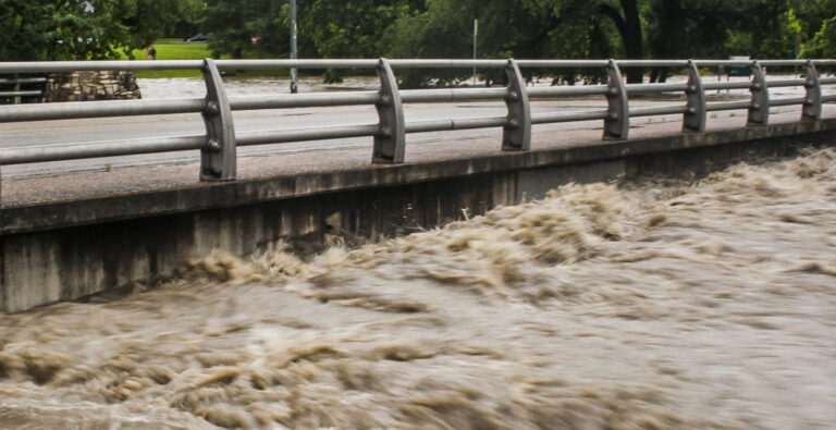
Flooding
As flooding becomes more prevalent in the region, it is important to understand what actions other cities and counties are implementing. CAPCOG has compiled the CAPCOG counties’ Flood Damage Prevention Ordinances and flooding studies and reports produced by CAPCOG, and cities and counties in the ten-county region.
Flood Damage Prevention Orders in CAPCOG
- Bastrop County Flood Damage Prevention Order, 2015
- Blanco County Flood Damage Prevention Ordinance, 1990
- Burnet County Flood Damage Prevention Order, 2009
- Caldwell County Flood Damage Prevention Ordinance, 2012
- Hays County Flood Damage Prevention Ordinance, 1998
- Fayette County Flood Damage Prevention Regulations, 2017
- Lee County Flood Damage Prevention Ordinance, 2016
- Llano County Flood Damage Prevention Order, 2009
- Travis County Chapter 464. Regulations for Floodplain Management and Guidelines and Procedures for Development Permits
- Williamson County Flood Damage Prevention Ordinance, 2008
Natural Hazard Risk Awareness
Flooding Studies from CAPCOG Member Governments
Other Flooding Resources
EPA’s Flood Resilience: A Basic Guide for Water and Wastewater Utilities
This guide is a one-stop resource to knowing flood threats and identifying practical mitigation options to protect critical assets.
The State Flood Assessment
This report provides an initial assessment of Texas’ flood risks, an overview of roles and responsibilities, an estimate of flood mitigation costs, and a synopsis of stakeholder views on the future of flood planning.
TWDB’s Flood Information Clearinghouse
The Texas Water Development Board (TWDB) developed an information clearinghouse about state and federal flood planning, mitigation, and control programs. The information may serve as a source of funding for flood projects. The site is a cooperative effort between the Texas General Land Office, the Texas Division of Emergency Management and the TWDB.
American Flood Coalition’s Flood Funding Finder
The Flood Fund Finder simplifies the federal grant system to aid small communities in identifying and prioritizing opportunities to fund flood resilience.
TWDB’s TexasFlood.org
Given the deadly nature of floods and the rapid timeframe in which they can occur, it is essential to be ready for the next flood event TexasFlood.org lists critical steps to take in each stage of the flood preparedness and response process.
American Flood Coalition’s Dual Disaster Handbook
The Dual Disaster Handbook is a comprehensive resource to help local officials and emergency managers address the dual disaster scenario of flooding during the COVID-19 pandemic.
Flooding Case Studies
Travis County revised floodplain development requirements on Atlas 14 (posted June 2019)
Travis County expanded its floodplain regulations for land development to include the Flood Insurance Rate Map’s (FIRM) 500-year floodplain instead of the 100-year floodplain after the release of the National Weather Services’ Atlas 14 historic rainfall study.
The change affects floodplain management and drainage infrastructure as new development projects will need more capacity to handle larger estimated rainfall totals and flood events. Although using the 500-year floodplain and the Atlas 14 data increases infrastructure construction costs for developers and landowners, it allows for more resilient infrastructure that can better withstand destructive weather and prevents spending on rebuilding infrastructure because of such events.
Completed in 2018, Atlas 14 provides more accurate rainfall values than estimates developed 40 to 50 years ago due to decades of additional rainfall data; an increase in the amount of available data, both in the number of stations and their recording periods; and improved methods used in the analysis. According to the study, Central Texas is likely to experience larger storms than previously expected which increases flood risks. Modeling for the 25-year, 100-year, and 500-year storms all expanded in their area and elevation because of the redefined rainfall intensities. In most cases, the new 100-year floodplain could encompass the previous 500-year floodplain.
Since it will take years for FIRMs to be updated, counties and cities have the authority to adopt higher floodplain standards to ensure new land development projects are designed and built to what will be the new 100-year floodplain once the jurisdiction’s FIRM is remapped.