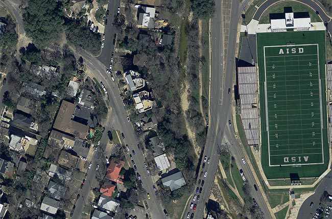
Access to the newest aerial imagery could mean the difference in seeing a new road, house or neighborhood by a first responder, so CAPCOG is providing local emergency communication centers (EECs) access to more frequently updated aerial imagery in 2023 to help keep up with the region’s growth. By subscribing to the Texas Imagery Service, the imagery EECs use for public safety and 9-1-1 GIS purposes will be delivered twice a year — once by the state and once by CAPCOG. CAPCOG published the region’s 2022 aerial imagery through Texas Natural Resources Information System’s (TNRIS) website, tnris.org, making it publicly available. The imagery has been used by local ECCs since it was delivered in June.
CAPCOG collects 12-inch aerial imagery to use as a base-map for address points and street centerlines, so emergency telecommunicators can dispatch public safety personnel to proper destinations. The imagery also serves as visual tool that can assist emergency responders; some uses could include locating a dirt road for an alternate access point to a property or identifying a clearing to land medical helicopter. Public uses for the imagery could help with environmental studies, locate future park land and more. The Texas Imagery Service captures every 12- to 24-month period by planning the CAPCOG imagery capture in-between the state captures; more frequent updates can be provided to 9-1-1 and other mission-critical users.